In Washington it rains a lot. Few people who have never lived here can understand the level of rain we get here. That means flooding.
There are numerous lakes in the Lacey Homes area. Many of the homes built around these lakes are not built on hills. Take a look at these photos.
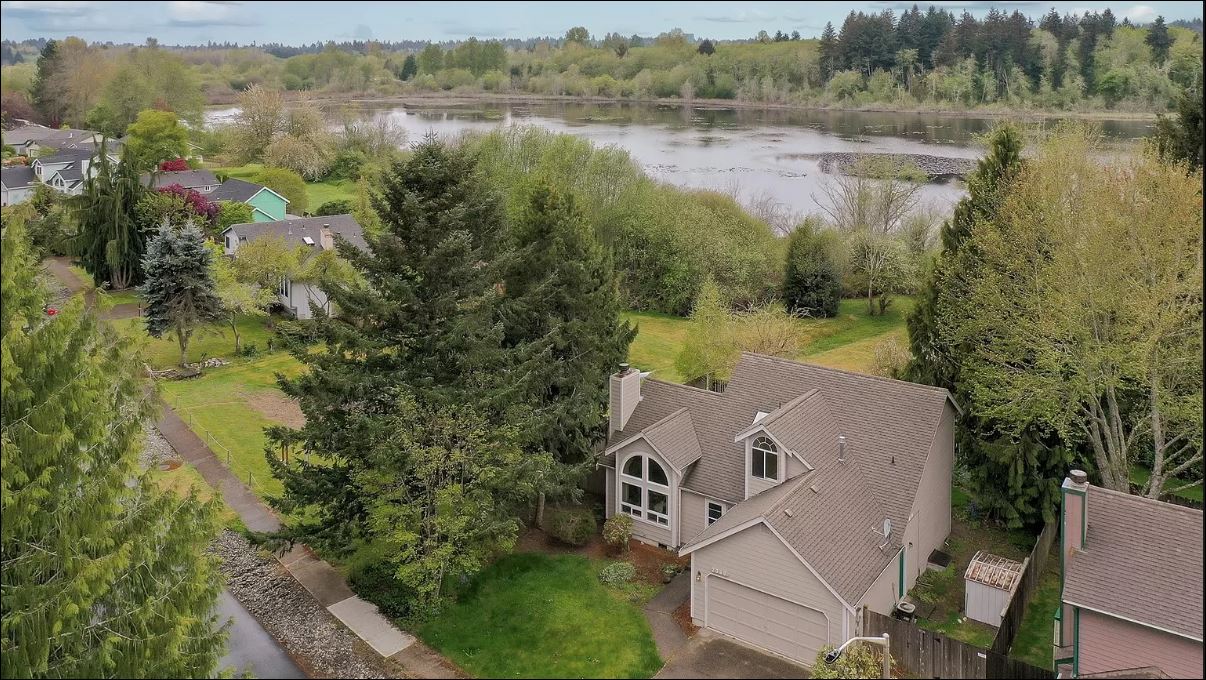
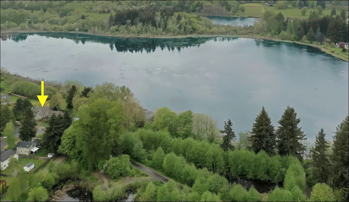
This is a beautiful home. If this was anywhere else, I’d want to move right in. Unfortunately, it’s right next to a huge “lake”. From the aerial photos this lake looks more like a swamp. Swamps are created from years of flooding. So I wouldn’t be surprised if this property was in a floodplain.
What’s a floodplain? A floodplain is an area of land that is susceptible to flooding when there is consistent rain or rain heavier than normal. If you look it up in the dictionary there are a few other definitions:
“A generally flat area of land next to a river or stream.”
According to this definition, this home is definitely on a floodplain. According to this definition, all of those “lakeside” homes are on floodplains. The exceptions are homes that have steep slopes up away from the lake. You will notice from photos online that there will be stairs in the backyard down to the lake access. This home does NOT have that.
“Composed of unconsolidated sedimentary deposits (alluvium).”
Alluvium is soil or sediment deposited by a lake or river. If part of your property is “swamp” then you are on a floodplain.
“Underlain by alluvium deposited by the associated river and is partially or totally inundated during periods of flooding.”
This is the definition we’re used to seeing. But you can’t just look at a property and know it’s past. Or what lies underneath it. That’s where a floodplain map comes in.
If you have a broker, then you have access to mls floodplain maps which are the easiest way to see if this property is on a floodplain.
If you don’t have a broker, then you can check many online sites that provide this service for free. Click here for the Washington Department of Ecology’s floodplain map.
Lacey Lake Home Take Two
Keeping our handy dandy ecology floodplain map link in mind, let’s look at another “lake side” property.
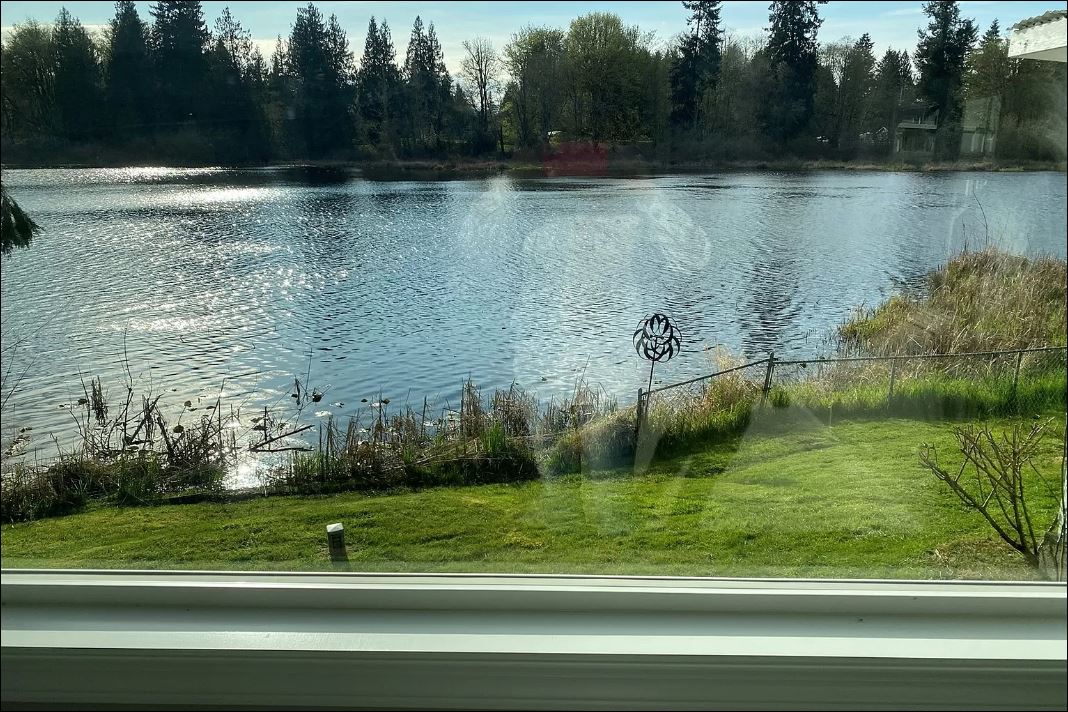
I don’t know about you, but if I had that view, I’d be terrified. The land is flat. Flat. So when that lake floods, it goes straight to that house. It is on a floodplain.
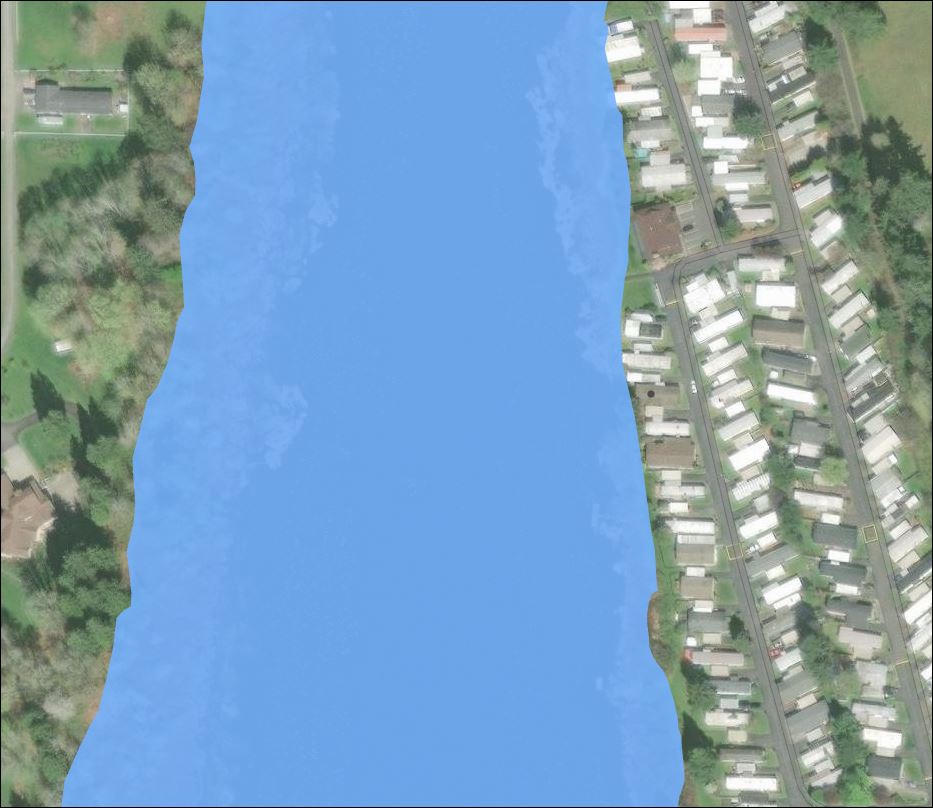
This is a snapshot of the Dept of Ecology’s floodplain map with this property. As you can see, most of these homes are partially underwater when it floods. NOT a good investment.
We get a lot of California transplants here and for someone from California, who hardly sees rain, it is difficult to conceptualize Washington rainy season which for the past few years has been 9 months of the year. Take a look at that floodplain map. That’s rainy season and what it can do to your home. So be careful when looking at properties. Investigate it yourself and make sure it’s a good investment.
Tip
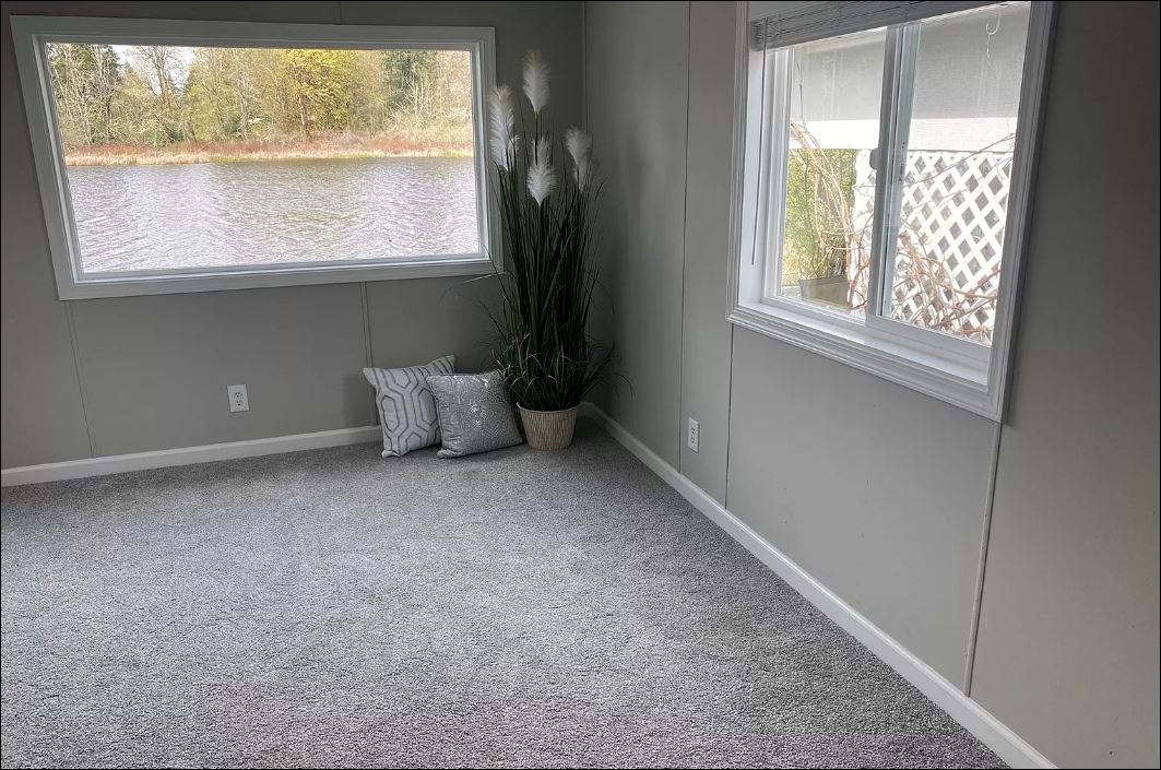
The easiest way to tell if a lakeside property is on a floodplain is the view. When you look at the online photos from the window of the property to the lake, you should be looking DOWN. Not across. Not up. Not into. DOWN. And it should be a distance away, preferably at the end of a dock. That’s precious space you need between your home and the lake should it flood.
I hope you’ve enjoyed this article about floodplains. Even in a competitive market like Lacey, houses are more than just real estate. They’re homes, where people live, and that means we want them to be functional, but beautiful too.


Leave a Reply